Sunday, April 17, 2016

Rodgers Lake Trail at Knik River Lodge

Length:  1.57 miles to the lake
Time:  It took us 2 hour 11 minutes round trip.  


A short 11 miles towards Knik Glacier, the gracious host at Knik River Lodge would love guest to come and enjoy this clearly marked trail.

Finding the Trailhead:  After parking, walk quietly through the private cabins that will most likely have guest to a newly build retaining wall.
Turn right and walk along the wall toward the mountain and come to a nice trail marker sign.


Pro's:  The trail is clearly marked.  There are opportunities to be deceived by game trails that go over the trail, but the nice stakes with orange and orange electrical tape is clearly marked every few 50 feet to make sure you keep your eyes on the trail.  

Nice rope to cross a creek and to have a hand hold up a steep gorge.  

A few great vistas for great overlook of the valley.

Perfect Lake to cool off at the end.  

Con's:  It soon can be overgrown because of the terrain. So, would recommend it for spring/fall hiking.  

Poles would be helpful for those timid of the steep sections coming up or down.  

Fun trip

Name:Rodgers Lake Trail
Date:Apr 17, 2016 2:56 pm
Map:
(valid until Oct 14, 2016)
View on Map
Distance:3.14 miles
Elapsed Time:2:12:06
Avg Speed:1.4 mph
Max Speed:7.3 mph
Avg Pace:42' 07" per mile
Min Altitude:330 ft
Max Altitude:717 ft
Start Time:2016-04-17T22:56:01Z
Start Location:
Latitude:61º 26' 02" N
Longitude:148º 45' 57" W
End Location:
Latitude:61º 26' 00" N
Longitude:148º 45' 50" W


Sunday, April 3, 2016

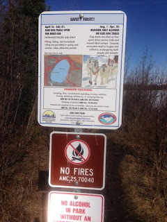
Beach Lake, Birchwood

Finding this trail in December 2015 on a blog, I finally tried it with a few friends.  And it worked.  It was a nice easy flat hike with amazing views.  We even saw Denali!


Directions from Palmer, AK.  Take the South Birchwood Loop Exit from the Glenn Highway. Turn right pass the Chugach High School.   After a chalet on your left, take a left onto Beach Lake Road and follow it over railroad tracks to the where it ends at a large parking lot. There is NO FEE, and restrooms (thank you).

The trail to the inlet starts to the left of the lake and follows close to the lake weaving in and out of the trees.  It is quite close to the lake at times, so watch your children when it bends back towards the water.


You can go inland away from the Lake and catch the mushing trail that is wider.  At the far end, there is a sign on the ground pointing the way to the inlet.  From this trail, you can take your pick of trails towards the inlet. 

 
Typically, there is a small stream that you can follow towards the beach.


Currently it was frozen with nice mud/icebergs floating in the inlet!

I was thankful a little extra hiking and exploring to the grassy area but was definitely too wet to sit.

 Please bring a change of clothes or something to protect the seats for the ride home.  That mud is soooo fun to play in.

The way back was easy to find a fun for all.


Our stats says 2.20 miles round trip, 238 ascent and 238 decent. We were very casual and took over an hour.